
This trip is going to be remarkably unstructured for a Cedric Trip. Usually, I know in advance which specific places I’ll be going on which specific days, because I need to book hotels in each area I’ll be visiting. But since Vermont is so small, I’ll be staying at one hotel the whole time, with each day’s activity being a day trip from that ‘central’ hotel. Also, as it turns out, every place I’m going has the same hours – 10 to 5 daily. So it truly doesn’t matter which day I choose to visit which place.
On the morning of Day 1, I whipped out my list of activities for Vermont, and chose to go with Mount Independence State Historic Site. Mount Independence is not exactly what most people think of as a mountain. It’s more of a plateau, one that rises out of the water on the eastern shore of Lake Champlain. Basically, it’s a peninsula with sheer cliffs on three sides. It is located at the lakes narrowest point (0.25 miles wide) and is directly across the lake from Fort Ticonderoga. Fearing the British military would attempt to sail down Lake Champlain, the Americans chose to fortify Mount Independence – all 300 acres of it! And it worked. At first. Together, Fort Ticonderoga and the newly fortified Mount Independence repelled the British once. But the British came back a few months later. This time, they noticed the Americans were not defending the nearby Mount Defiance, which is much higher than Mount Independence. So the British hauled a few cannon up Mount Defiance, from which they could see everything going on the two forts, and could easily fire their cannon down into the two forts. Not surprisingly, the Americans abandoned both forts rather hurriedly. The British took up residence at Mount Independence, and even made improvements to the joint, constructing many new buildings. However, they decided to abandon the site after only a few months, politely burning everything to the ground on their way out.
Today, visitors to the Mount Independence State Historic Site can hike over six miles of trails to enjoy views of Lake Champlain and see foundations of the various buildings that were erected during that brief moment in time when this massive rock was also a fort. The visitor center also contains a small museum that displays Revolutionary War artifacts that have been dug up on Mount Independence, and of course, tells the whole story in much more detail than I did above.
I started by watching their introductory video, then I hit the trails. As I left the visitor center, I noticed a table just outside the entrance. On this table were three cans of OFF!® I should have taken this as a warning. I didn’t. I did not apply any insect repellant, I just headed out onto the trails. I chose to hike the shortest trail first. This trail (known as the Red Trail) is a mere 0.2 miles long, but it goes all the way down to the water’s edge from the parking lot, a descent of about 120 vertical feet. There wasn’t a lot to see down there, but I did get this picture:

Having handled such a steep and rough (though short) trail with ease, I was encouraged to take on what I would call the “main” trail (actually known as the Green Trail). This trail appears to have more historical remnants than the others and has several large interpretive signs containing tons of info on each site it passes. I enjoyed reading the signs at the first couple of ‘stops’. At the third stop, I was joined by mosquitoes. Not many, just a couple. They seemed to want something from me. I seemed to want to murder them. Fortunately, the weather was cool enough that I was wearing jeans and long sleeves, so my only exposed skin was my hands and face. And them skeeters had no chance of landing on my hands, because the hands were in constant high-speed movement, swatting / clapping / grabbing at the skeeters around my head.
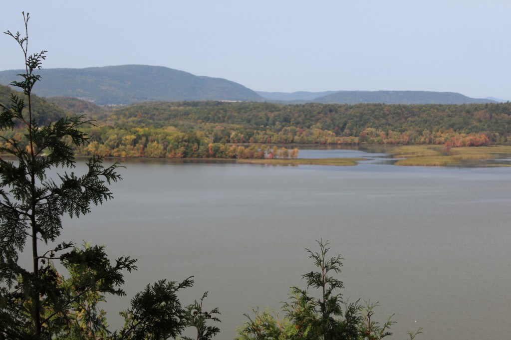
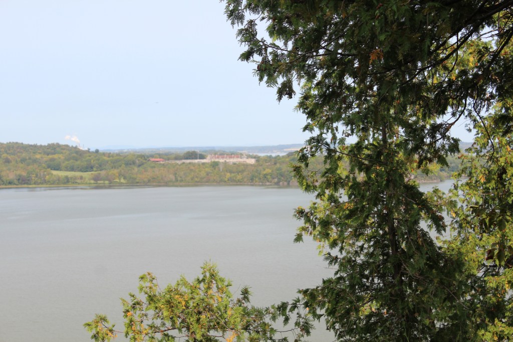
This continued for some time. Whenever I was on the move, my airspace was clear. Whenever I stopped, a fresh pair of mosquitoes would materialize and come at my head. So I decided to stop reading the interpretive signs and just finish out the hike. But then the trail took a turn into a wetter part of the forest, where the mosquitoes were out in greater numbers. At this point, I was late for my next scheduled dose of Levodopa, and I was feeling the Parkie fatigue in my legs. I had the pills and a bottle of water in my backpack, but I wasn’t about to stop and take meds in midst of this maelstrom. By the time I got back to the car, I was fully exhausted – ready to call it a day. Oh, hey! I took these pics from an overlook along the way:
Whew! I feel like I just wrote a report for my fifth-grade history class.
